
MoRPh: Diving into detail
By capturing detailed information about the physical habitat of a short length of river, MoRPh provides a flexible way to quantify, map and track changes through time in the river’s physical habitat mosaic.
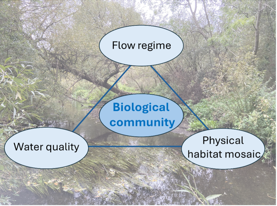
Physical habitat, water flow and water quality are the key local environmental controls on the biological community in a river. Monitoring of these three components provides insights into how the river environment changes at a site and between sites along a river. This monitoring also helps to explain why changes are observed in the biological community.
MoRPh is designed to provide details of the physical habitat mosaic within short lengths of river. It is unique in providing habitat data at a scale that matches that of biological and water quality monitoring.
Below, learn how physical habitat surveys, including MoRPh, offer complementary information and can be combined; how to choose the most appropriate survey for your needs; and what answers MoRPh and other surveys can deliver.
The opportunity: learning from MoRPh
By capturing detailed information about the physical habitat of a short length of river, MoRPh provides a flexible way to quantify, map and track changes through time in the river’s physical habitat mosaic. MoRPh survey data are stored within an information system which allows you to view, explore and download any of the data and photographs. This flexible system helps you to answer questions about physical habitat assemblages in a river and their associations with organisms such as fish or invertebrates.
How MoRPh works
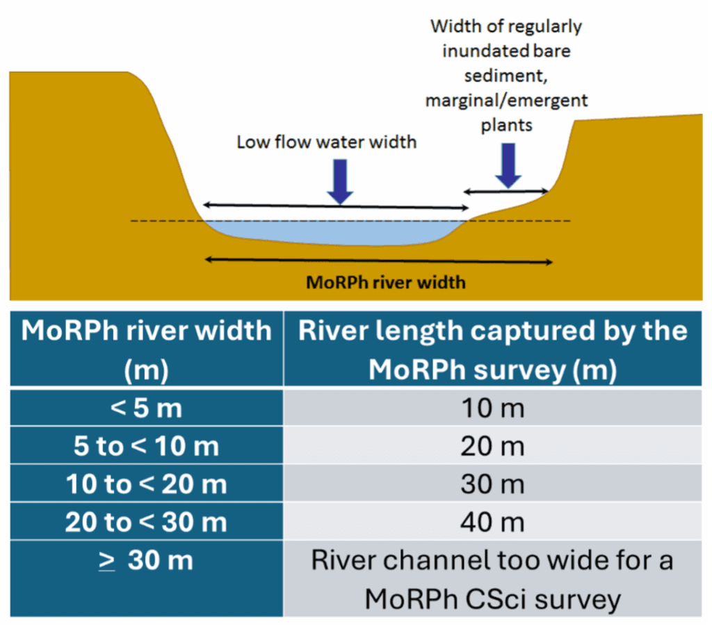
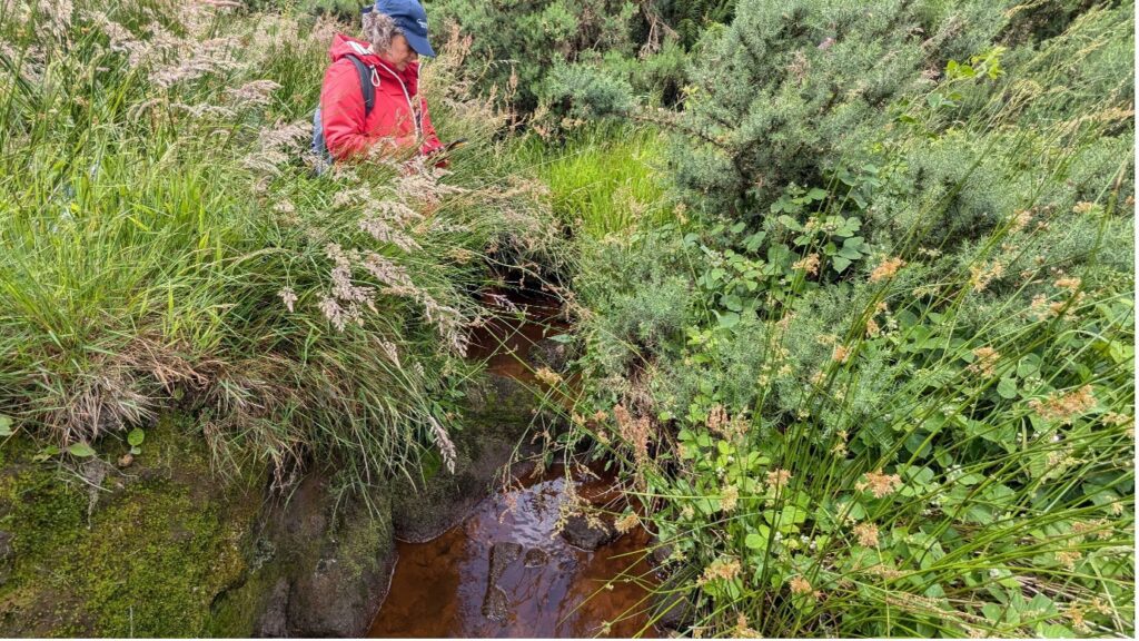
MoRPh is a tool for monitoring sediments, physical and vegetation structural features, and human influences in detail along short lengths of a river. The river length surveyed ranges from 10 m to 40 m, depending upon the width of the river. The detail of the survey data is sufficient for small changes to be tracked by repeatedly monitoring the same site over time.
MoRPh records the extent of a list of physical features within a rectangular area enclosing a length of river and subdivided into the two bank tops, two bank faces and river bed areas of the surveyed river length. Photographs illustrate the area covered in each survey.
14 summary indicators are automatically computed for every MoRPh survey, allowing changes in their values along a river to be mapped and changes through time at a site to be graphed. To characterise longer river lengths, 10 end-to-end MoRPh surveys can be conducted so that 16 summary indicators can be automatically computed for the total surveyed length.
The lasting impacts of MoRPH
MoRPh is best used to track river condition and the impacts of restoration measures over the long term.
It is a simple and quick method, with a single survey taking approximately 30 minutes so that multiple sites can be surveyed in a single day. This allows citizen scientists and researchers to repeat MoRPh monitoring easily on a yearly basis.
The greatest value of MoRPH is that it provides an immediate, robust, detailed assessment which can be used as a baseline for evaluating changes. For example, it can be used to track the outcomes of restoration efforts and changes, revealing what practices are and are not working.

What MoRPh can tell us
MoRPh surveys can be used to answer three main types of questions about the river environment:
- To what extent do changes in natural processes, such as the occurrence of floods and extreme low flows, affect the physical condition of a river?
- To what extent do human pressures and interventions, such as soil erosion, vegetation management, weir removal, wetland creation, NFM measures or river restoration, affect the physical condition of a river?
- To what extent do variations in the physical condition of the river help to explain variations in biological communities?
Yorkshire Dales Rivers Trust
Partners: Yorkshire Dales River Trust and Don Catchment Rivers Trust
Introduction: After discovering MoRPh through CaSTCo, the Yorkshire Dales River Trust and Don Catchment Rivers Trust are adopting the survey in a variety of contexts. In particular, MoRPh is being used to complement Riverfly monitoring and to help understand the ways in which physical habitat may be influencing the macroinvertebrate community. Additionally, MoRPh is being used to better understand how local interventions and larger restoration projects may be enhancing the mosaic of physical habitats within the affected river.
Volunteer Engagement: Many volunteers were already trained in the Riverfly method when they underwent MoRPh training. MoRPH is allowing them to explore and better understand how physical processes and the changing physical character of a river may affect their Riverfly observations. During MoRPh training, volunteers were also given more information about the impacts of human interventions on the physical character of rivers and how MoRPH could be used to track these responses. Overall, volunteers were excited to gain more knowledge and see the river through a more holistic lens.
National database: Although the national MoRPh database currently stores around 8000 surveys, many parts of Yorkshire have not been surveyed. By adding surveys from across the Yorkshire Dales and River Don to the national dataset, the volunteers are playing an important role in enhancing this national coverage.
“There is a real need to monitor and to keep learning from river restoration, and MoRPh is the tool that can give the necessary spatial and temporal detail on the impacts of specific restoration measures.”
Angela Gurnell, Cartographer
Mersey Rivers Trust
Partners: Mersey Rivers Trust
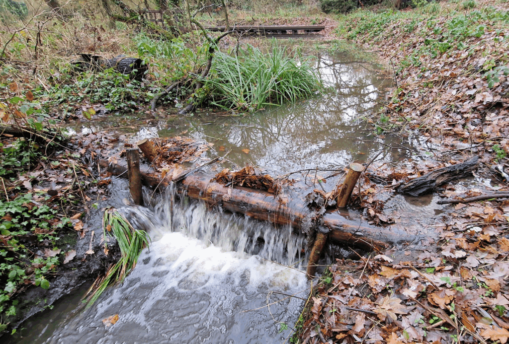
The Mersey Rivers Trust is using MoRPh to track the impacts of natural flood management (NFM) techniques, especially leaky barriers, on the physical characteristics of the river around these installations.
The Trust are installing leaky barriers to help attenuate high flows and thus reduce downstream flood risks. However, by attenuating high flows, these structures moderate a key process, flow, that shapes the physical size and structure of the river channel.
MoRPh surveys are providing the information necessary to understand the impact of leaky barrier installations on the physical habitat of the Mersey and its tributaries. Three survey sites are established upstream and downstream of a leaky barrier. These sites are then monitored using MoRPh before barrier installation to provide a baseline. Following installation, the same sites continue to be monitored to track physical habitat changes in response to the structures.
This method – baseline followed by continuing monitoring – is now mandated by the Environment Agency to monitor and understand the impacts of natural flood management measures.
“To date, over 8000 surveys have been recorded in the MoRPh Citizen Science information system.”
Helen Moggridge, Cartographer
The Wye and Usk
Partners: Wye and Usk Foundation
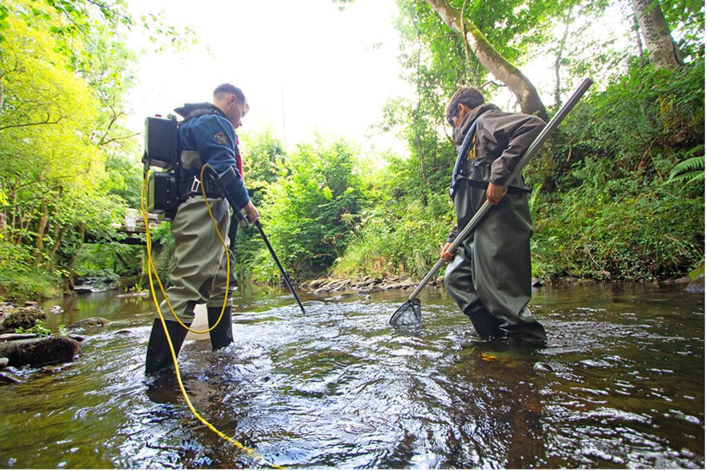
The Wye and Usk Foundation (WUF) has been carrying out MoRPh surveys at sites that are also surveyed annually through the WUF electrofishing programme to monitor numbers of juvenile fish populations (salmon and trout). WUF survey records date back 14 years and represent a considerable body of data.
In 2025, five rivers were surveyed in the catchment, with 40 MoRPh surveys carried out at 20 locations, to coincide with locations where electrofishing is to be carried out between July and September.
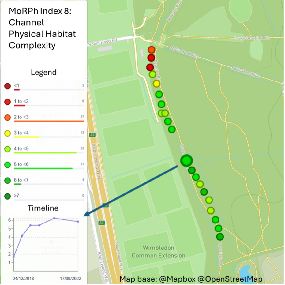
This work aims to understand if there is a correlation between MoRPh indices (with specific focus on Channel Physical Habitat Complexity and Riparian Physical Habitat Complexity) and higher counts of fish fry at specific electrofishing locations in the Usk Catchment. Factors affecting fish fry survival in the first 6 months include water temperature, river flow, turbidity levels, nutrient levels, food availability, channel substrate, and cover from predation. Climate change exacerbates these pressures through temperature and rainfall highs and lows.
Analysis of electrofishing records combined with examining results from water nutrient level testing, RiverFly and turbidity monitoring are required to better understand how MoRPh surveys can be best utilised for possible correlations.
The gathered data will be used to influence future work in WUF, to help direct the habitat team to areas that require restorative works and for future project bids to improve fish habitats and therefore survival.
“CaSTCo funding has greatly accelerated the development of MoRPh including fine-tuning all documentation, developing and delivering two new online training courses, training many new MoRPh surveyors, and engaging intensively with the river trust community”
Angela Gurnell, Cartographer
The Crane Valley
Partners: Thames Water and Crane Valley Partnership
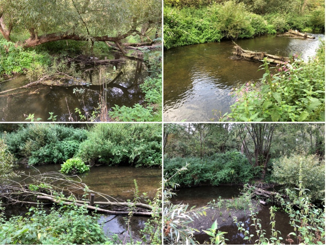
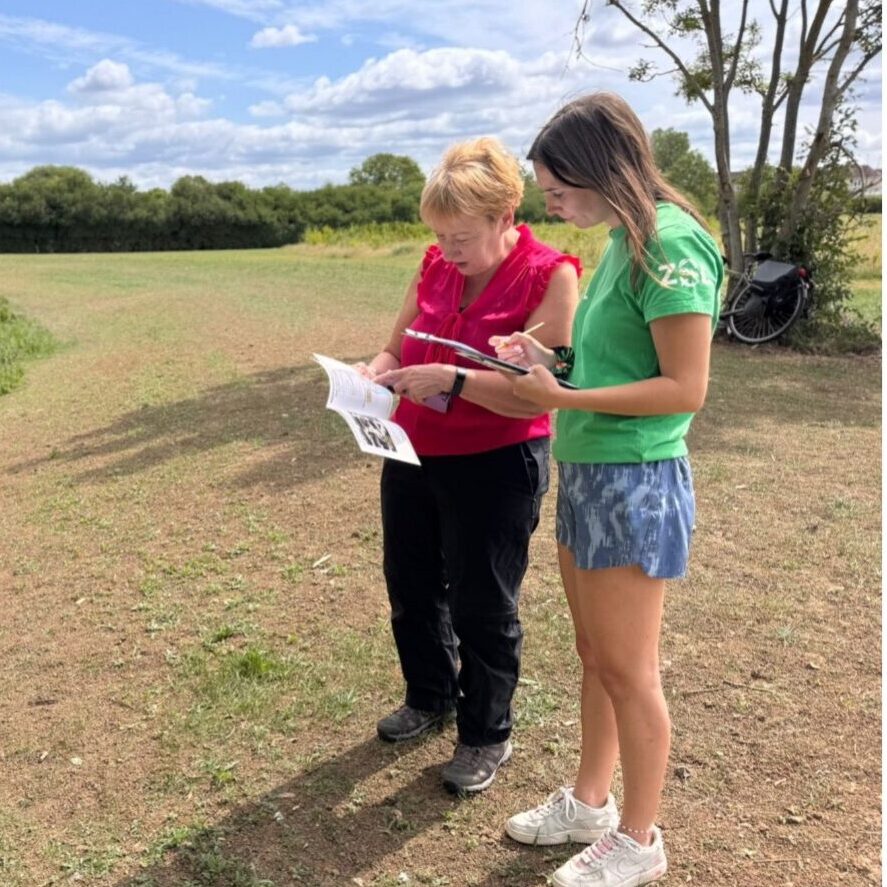
Introduction: The Crane Valley Partnership has always had a very active community of volunteers. Over the last four years, as part of the Thames Water funded Smarter Water Catchment programme, MoRPh has been widely adopted across the Crane catchment to increase knowledge of the physical habitat characteristics of the river; to link macroninvertebrates to physical habitat at Riverfly monitoring sites; and to track the impacts of river restoration measures. The last two items have been conducted in collaboration with the Zoological Society of London.
Reversing the effects of historical river management: Over the last 200 years, land cover across the catchment has progressively changed from being largely agricultural to predominantly urban. Historical management of the river has maintained relatively straight, uniform channels that are often too deep, because of long term maintenance, but occasionally are too wide because of channel modifications to support specific industries. These historical modifications have presented clear opportunities for river restoration and the local community are contributing to monitoring their effects. MoRPh is being used to establish crucial baseline data on the river’s physical characteristics before restoration and to gather longer-term baseline data for ‘control’ reaches that are not restored as well as for the restored reaches. Tracking and comparing survey data through a pre-restoration, post-restoration and post-recovery sequence in the ‘control’ and ‘restored’ reaches is revealing the impact of specific restoration measures to feed into improved restoration design.
Returning to the community: Researchers involved in the MoRPh project are continually engaging with community volunteers. This collaborative effort focuses on the consistent collection of MoRPh survey data and interpretation of that data. The resulting dataset provides a comprehensive resource for scientists, volunteers, and the broader community, facilitating an understanding of environmental changes and clearly demonstrating the direct impacts of interventions.
The future of MoRPh
The conjunction tool: MoRPh complements physical habitat surveys that capture information for longer river lengths but in less detail. The local scale and greater detail of MoRPh makes it uniquely suitable for monitoring subtle changes in the presence and abundance of physical habitat features. Whether in response to changes in natural processes or human pressures or to the direct effects of human interventions, MoRPh will track small adjustments in the mosaic of physical habitats. These strengths make it uniquely suitable for monitoring that aims to link the biological, water quality and physical structural aspects of specific sites.
MoRPh as a tool for learning: MoRPh surveying can act as a learning tool at individual monitoring sites, in classrooms and across organizations. When linked with biological survey data, MoRPh observations foster a better understanding of interactions between the geomorphology and biology of rivers that can underpin increasingly sustainable river management.
Reminding us that rivers change: If sites are monitored at least annually, MoRPh data can describe how a river is changing in the medium term. This allows volunteers and river guardians to see the trajectory of changes that are occurring at sites across their catchment. We know rivers change, MoRPh can help us to see this.