
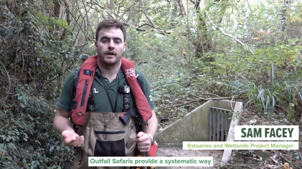
Outfall Safari
Outfall Safaris help communities identify hidden pollution from surface water outfalls, providing data that supports clean-up efforts by Thames Water and environmental partners.
Finding the unknown pollution sources
Pollution from surface water outfalls can harm our rivers, even in places where drains should carry only rainwater. Outfall Safaris help identify these hidden pollution sources.
Trained volunteers survey riverbanks, while staff tackle harder-to-reach areas in the channel. The findings are shared with Thames Water, Catchment Partnerships, and the Environment Agency, helping guide clean-up efforts through Thames Water’s Surface Water Outfall Programme (SWOP). It’s a practical way for communities to protect their rivers.
Outfall Safari is an officially audited CaSTCo method.
You can find more training resources by visiting the official Outfall Safari webiste.
The problem: unexpected sewage leaking into rivers
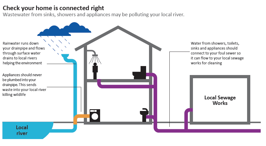
In many English towns and cities, sewage and rainwater flow through separate pipes. Sewage goes to treatment plants, and rainwater flows into rivers. But sometimes the systems get crossed (due to mistakes, blockages, or broken infrastructure), causing sewage to leak into rivers. Separate from sewage overflows, this “diffuse pollution” is an often overlooked driver of urban pollution. We still don’t know how much they contribute, so more surveys of urban rivers are needed to better understand their impact.
The magic of Outfall Safari is that it works with communities, who are the eyes on the ground, to pinpoint where further investigation is needed, and then works with those with the tools to help do something about it.
Who
- Zoological Society of London – Outfall Safari Programme leader
- Thames Water – Funder with data guiding investment into removing sources of pollution.
- Delivered with local Catchment Partnerships (Thames21, South East Rivers Trust), NGOs (including Rivers Trusts), the Environment Agency, and community groups across the Thames catchment
Where
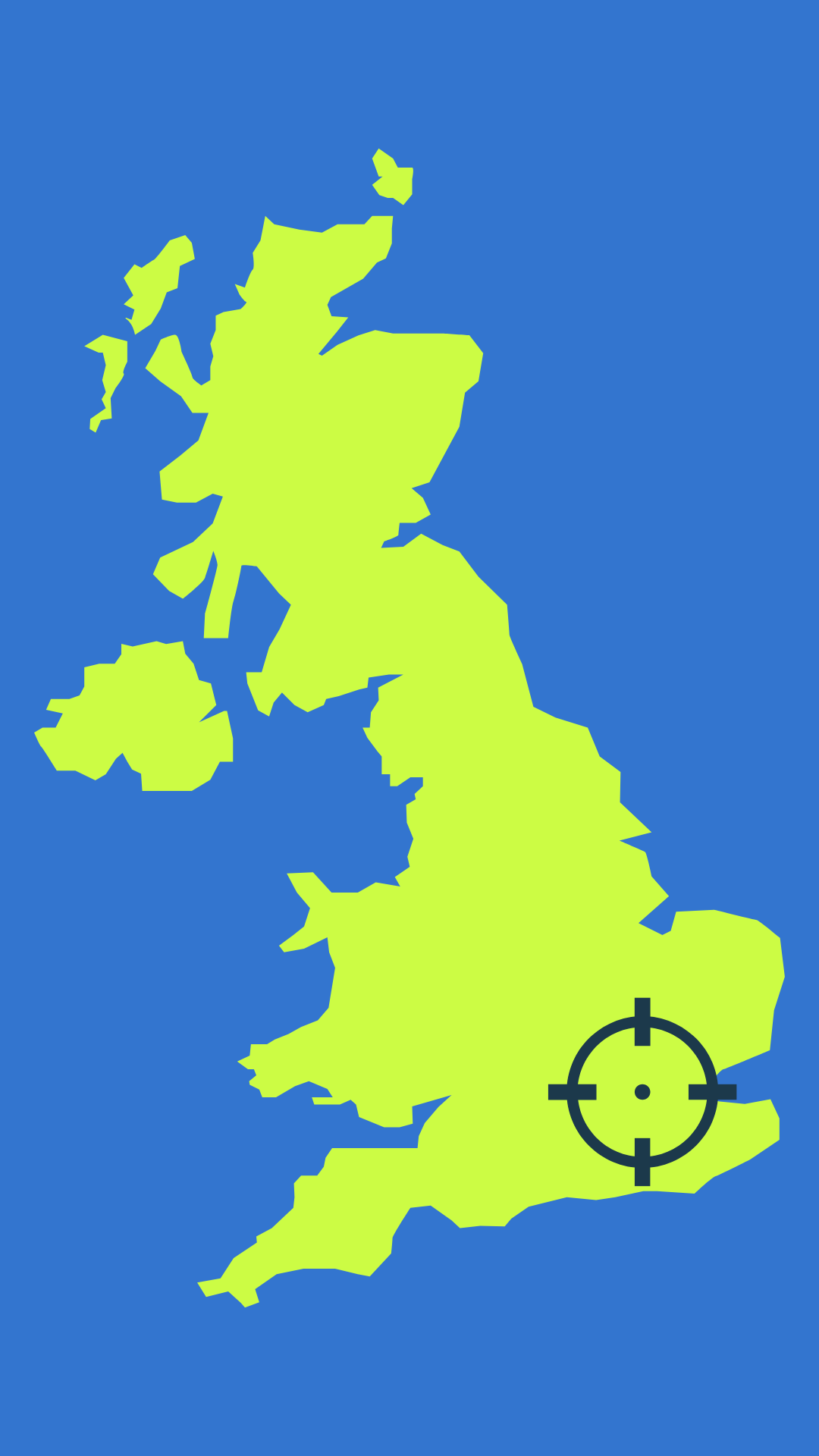
Outfall Safais take place on four rivers across Greater London each year. Every river in London is surveyed in a 4-year cycle.
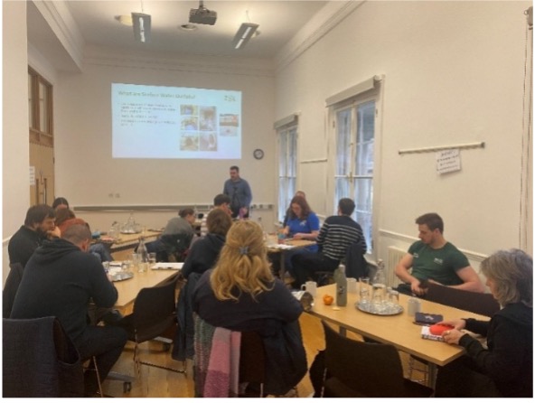
Presenting our findings to our community and partners
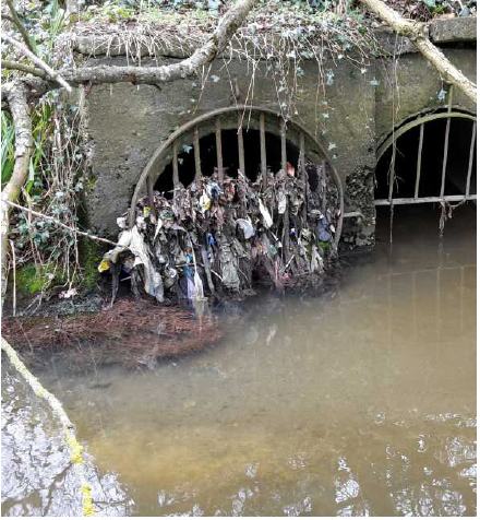
A potential source of diffuse pollution in the Thames River?
Presenting our findings to our community and partners

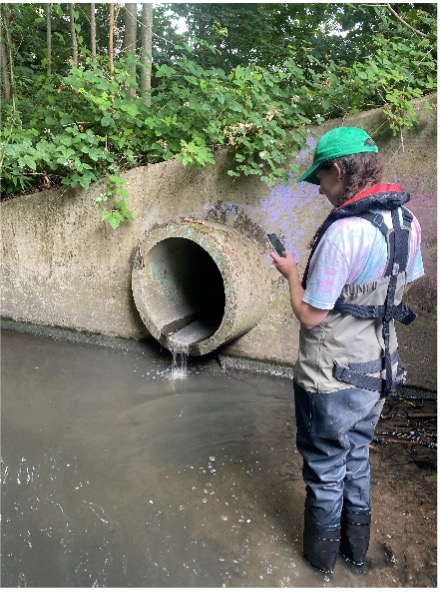
In-channel Outfall Safari survey

PSWO CCTV (credit Thames Water)

The tools in our method
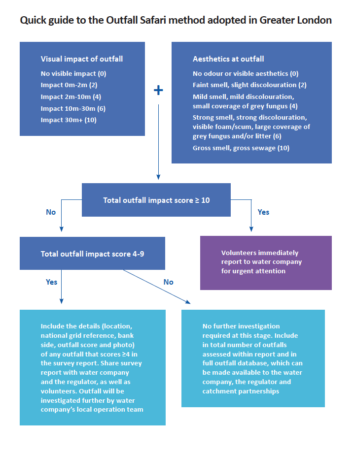
Volunteer training: Volunteers attended a 2-hour, ZSL-led training session that included an overview of local river pollution issues, instructions on how to assess outfalls, a Health and Safety briefing, information on how the survey is coordinated, and apportionment of reaches to volunteers for the survey.
Bankside surveys: Volunteers selected the reach of the river they would like to survey. Their surveys involved walking along a chosen section of the river with the Outfall Safari app, locating outfalls, and scoring them using the Water UK and EA assessment questions.
In-channel surveys: Once volunteers completed their surveys, ZSL staff filled in any gaps where surveying was not possible from the bank by going in-river and locating and ranking the pollution using the same method.
Data processing: ZSL coordinated the survey and gave feedback to volunteers as the survey progressed, via Padlet. All data uploaded from the river was checked for accuracy before final reporting to Thames Water, Catchment Partnerships and Environment Agency.
4,465
outfall assessments conducted
671 km
of river surveyed
490
volunteers engaged
65%
of the outfalls on SWOP in AMP7 were reported via Outfall Safari
Results
- Identified 638 polluting outfalls (outfalls scoring ≥ 6)
- Identified 162 highly polluting outfalls (outfalls scoring ≥10) that have been reported from the river for immediate action to stop the source of pollution
- Found, on average across London, one polluted surface water outfall (PSWO) per km of river surveyed and evidenced the worst-impacted river in terms of density of PSWOs
- Fed data into the Greater London Authorities’ River Health Map and the London Mayor’s plan for cleaning up rivers
- Directed Thames Water investment into resolving the polluted surface water outfalls problem. Approximately 65% of the outfalls on Surface Water Outfall Programme (SWOP) in AMP7 were reported via Outfall Safari!


Key learnings
Although Outfall Safari was originally developed to identify misconnections, it has also helped highlight other pollution sources from polluted surface water outfalls (PSWOs), such as blockages and failing infrastructure.
Table 3 shows the causes of PSWO pollution in London that Thames Water addressed during Asset Management Period 7 (2020–2025).
What we learned
Even in the absence of a SWOP, quantifying the scale of pollution can help make the case for water company investment and prioritisation of this issue.
We found that flexibility is essential when teaching the Outfall Safari method, as not all water companies have a Surface Water Outfall Programme (SWOP) like Thames Water.

Deep dive: Pollution sources found using Outfall Safari
Misconnected pipework
Between 2020 – 2025, volunteers found 1,314 incidents of misconnected appliances and/or defected pipework. These physical miconnections and defects are some of the greatest threats to water quality, sending pollution into rivers and compromising the biodiversity and amenity value of waterways.
Using the Outfall Safari app, volunteers completed an assessment form, with answers converted into an impact score with a max of 20. If the score is greater than or equal to 10, volunteers immediately report to the water company for urgent attention.
Once reported to Thames Water, their Network Operations and Environmental Protection Team work to trace the source of the pollution.

Missing surface water caps
Between 2020 – 2025, volunteers found 500 incidents of missing private surface water caps.
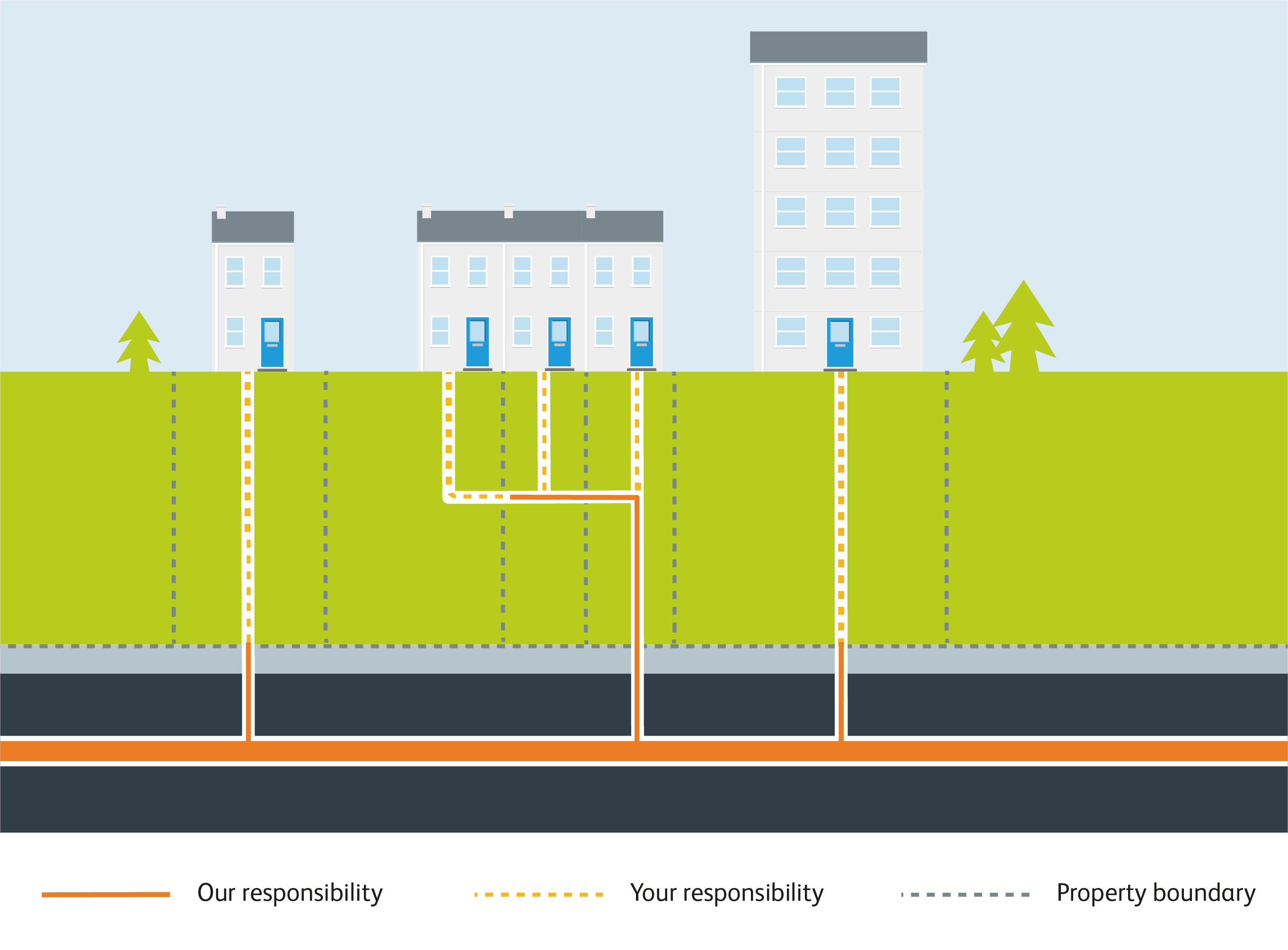
These are blockages that specifically occur in a customer’s private drainage system, before they reach the sewers. Often, the blockage can lead to sewage overflowing and entering the surface water systems, polluting the local watercourse.
In the photo, you can see the numerous ways in which Thames Water remediated such incidents!
Private blockages
Between 2020 – 2025, volunteers found 291 incidents of private blockages.
These incidents involve private properties where surface water caps are missing. This can cause sewage to enter the open cap and be discharged to the local watercourse, polluting surface waters and causing harm to local aquatic life and river biodiversity.
To remediate this, Thames Water offered to replace the cap free of charge to the customer. Permission is needed to do this.
Private and private defects
Between 2020 and 2025, volunteers found 102 incidents of private defects and 269 incidents of public defects.
Private defects encompass any defect except those not defined elsewhere. This designation covers a diverse array of uncommon and potentially unique defects, with one similarity being that the issue relates to the customer’s private drainage system.
Public defects are the responsibility of Thames Water to rectify, as it has occurred to the part of the drainage system that Thames Water is responsible for.
For both categories, as each incident is unique, the response is tailored to the specific situation.

A multi-faceted purpose, with diverse data sources
The Outfall Safari Programme moves into all aspects of monitoring purpose, with community engagement at the heart of it. By moving through to investigation and resolving issues, Outfall Safari provides mechanisms to allow the community to improve rivers meaningfully and provide an interface between those with the means to do so.
This scheme also demonstrates CaSTCo’s ‘Weight of Evidence’ approach, combining data from community surveys with detailed surveys and data from both the EA and the water company. It’s blending these different data sources together that makes this program so successful!
As part of the CaSTCo project, Outfall Safari also ran three “Train The Trainer” sessions between December 2024 and January 2025 in the Anglian, Teme and Mersey demos, expanding the method into other regions. Plus, through the rollout of the Cartographer app and database for the collection of Outfall Safari data across the UK, and updated guidance (supported by ten CaSTCo partner organisations), integrating in user feedback, has built a robust toolset for the entire country.
Demonstrating CaSTCo principles
Collaboration
The Outfall Safari was developed in collaboration with a range of organisations in London, including local communities, organisations, NGOs, water companies, and regulators to collect data on polluted surface water outfalls (PSWOs).
Open
Our data is available upon request and is shared annually with all stakeholders, local policymakers, and citizen scientists. Further prototypes to share data openly and allow data to be easily combined with other datasets for bigger impact are underway.
Impactful
Since 2016, the Outfall Safari in London has conducted 4,465 outfall assessments and identified 638 polluting outfalls, engaging 490 community members across Greater London. The data is shared across all stakeholders and has been fed into the Greater London Authorities River Health Map and will be used as part of the evidence base to inform the Mayor of London’s plan for clean and healthy waterways.
Outfall Safari has also laid the foundations for building similar programmes in other cities and regions!

Being part of CaSTCo has shown me the power of collaboration. Training others to run their own Outfall Safaris helped spark important conversations between NGOs and water companies, and the shared learning across regions has been invaluable. I’ve seen how working together can break down barriers, reduce duplication, and build towards a future where every UK city is monitoring PSWOs and contributing to a national dataset.
Elizabeth Witcombe, Estuaries and Wetlands Project Officer at ZSL